Request for Proposals:
Parks and Jessups Creeks Floodplain Mapping
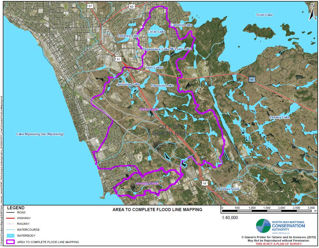
(July 10, 2019) The North Bay-Mattawa Conservation Authority (NBMCA) is undergoing the process of updating its floodplain mapping, which was completed during the 1980’s. The next subwatersheds to be updated are the Parks and Jessups Creeks subwatersheds with the remaining subwatersheds updated in subsequent years, funding permitting.
NBMCA invites proposals from qualified consultants to provide technical and engineering services to update the existing floodplain mapping of Parks Creek and Jessups Creek in the City of North Bay.
The regulatory floodplain is used by NBMCA during the administration of Ontario Regulation 177/06 - Development, Interference with Wetland and Alterations to Shorelines and Watercourses (DIA), pursuant to Section 28 of the Conservation Authorities Act.
A principal mandate of NBMCA is to prevent the loss of life and property due to flooding and erosion and to conserve and enhance natural resources. Ontario Regulation 177/06 is a key tool in fulfilling this mandate because it regulates development in areas where the control of flooding, erosion, dynamic beaches, pollution of the conservation of land may be affected by development. Floodplain mapping is also used by municipalities in preparing official plans and zoning by-laws, which guide future development in their municipalities.
Floodplain mapping is used to identify areas that may be susceptible to riverine or coastal flooding during large storm events. Floodplain mapping relies on supporting analysis, including hydrologic and hydraulic modelling. Hydrologic modelling predicts how much runoff will be generated by a rainfall event. Flows generated by the hydrologic model are then inputted into the hydraulic model to predict the peak flood depth, elevation, and velocity of flood flows. The flood elevation is mapped using topographic data (the natural features of the land) to show the limits of the floodplain and other critical information.
This project is funded by the City of North Bay as well as Public Works Canada's National Disaster Mitigation Program, administered through the Ontario Ministry of Municipal Affairs and Housing. Project completion is scheduled for March 2020.
Four copies of the proposal, clearly marked “Proposal for the updating of the Parks and Jessups Creeks Floodplain Mapping Project” must be received by NBMCA no later than 4:00 p.m. EDT on August 6, 2019* at: North Bay-Mattawa Conservation Authority, Attention Kurtis Romanchuk, Water Resources Engineer, 15 Janey Avenue, 2nd Floor North Bay, ON P1C 1N1. (*Note revised deadline)
- RFP 19 01 Parks and Jessup Creeks Floodplain Mapping
- RFP 19 01 Addendum 1 Parks And Jessups Creeks Floodplain Mapping
- RFP 19 01 Addendum 2 Parks And Jessups Creeks Floodplain Mapping
- RFP 19 01 Addendum 3 Parks And Jessups Creeks Floodplain Mapping
- RFP 19 01 Parks and Jessup Creeks Floodplain Mapping.bmp
Contract Awarded to Waters Edge Environmental Solutions Team
(August 20, 2019) Several proposals were received by NBMCA from qualified consultants to perform the Parks and Jessups Creeks Floodplain Mapping Project. The proposals were scored on the basis of the proponent’s qualifications, the technical merit of the proposal, and the price to complete the project. Based on the scoring, the Parks and Jessups Creeks Floodplain Mapping Update Project was awarded to Water’s Edge Environmental Solutions Team. Water’s Edge is an engineering consulting firm based on Cambridge, Ontario which specializes in water resources engineering and fluvial geomorphology, and has completed numerous floodplain mapping projects across Ontario. NBMCA and Water’s Edge look forward to presenting the updated floodplain mapping to municipalities and the public in Spring 2020.