(North Bay, Ontario, July 7, 2020) North Bay-Mattawa Conservation Authority (NBMCA) has prepared two comprehensive documents as they relate to permitting and plan review and updated its approximate regulated area screening maps. The public is invited to submit comments.
The “Planning and Development Administrative Procedural Manual” has been created to allow the public to better understand and navigate the permitting and review processes of NBMCA’s Planning, On-site Sewage Systems, and Regulations programs.
The “Policies for the Administration of Ontario Regulation 177/06 Development, Interference with Wetlands and Alterations to Shorelines and Watercourses” document has been created to provide a clear understanding of NBMCA’s role, mandate and responsibilities relating to the Conservation Authorities Act and permitting process.
“NBMCA has consolidated existing policies and practices in these documents while ensuring consistency with the Provincial Policy Statement and technical guidelines prepared by the Ministry of Natural Resources and Forestry,” said Paula Scott, NBMCA’s Director of Planning and Development.
“The goal is to further improve customer service and offer more transparency in our work,” she added.
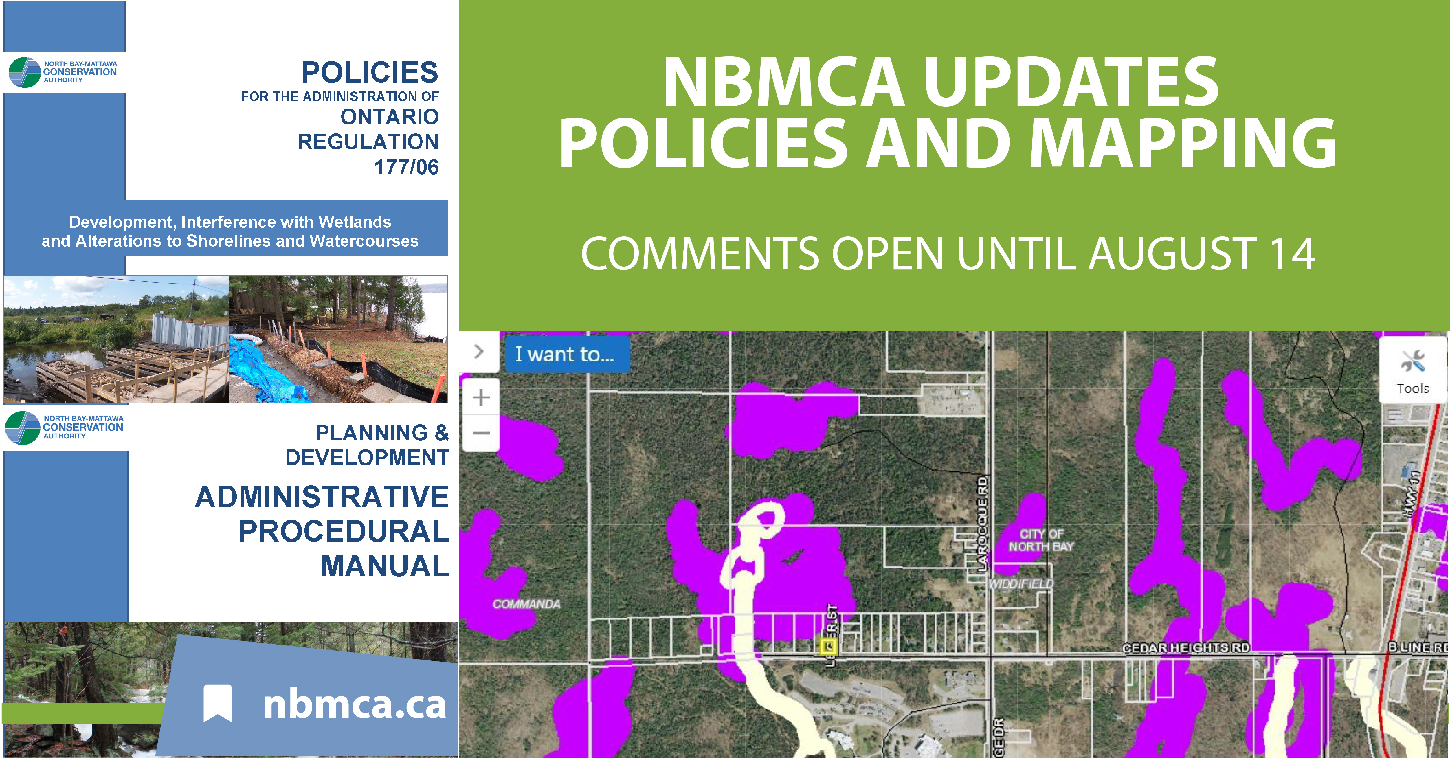
As well, NBMCA recently completed an update to the wetland mapping information to better reflect the features on the landscape. The update provides more accurate and up-to-date "Approximate Regulated Screening Maps" that are used to identify properties which fall within NBMCA’s regulated area.
“There have been several advances in technology, mapping and modelling which have allowed us to refine and update our approximate regulated area screening maps. As we’ve done in the past, we’ll visit a property at the request of an applicant to verify the site conditions and determine if a development proposal falls within the regulated area as defined by legislation,” said Scott.
NBMCA has an online mapping tool which the public can use to view the maps. A search function allows property owners to search by property address and see if their property falls within the approximate regulated area.
“If a property falls within a regulated area, the property owner may require a permit for development to help protect their project from impacts of flooding and erosion,” she added.
The Planning and Development Procedural Manual, the O.Reg 177/06 Policy Manual, and the updated Approximate Regulated Area Maps are available for viewing online at www.nbmca.ca under Planning & Development.
Public comments are invited until August 14, 2020. Online comment forms are available on the webpage for each of the manuals and the updated screening maps through the nbmca website.
The North Bay-Mattawa Conservation Authority (NBMCA) was founded in 1972 by the Province of Ontario and the NBMCA’s 10 member municipalities. A non-profit organization, the NBMCA works closely with the public to balance human needs with the environmental needs of the region’s watershed. The NBMCA is one of 36 Conservation Authorities who are members of Conservation Ontario.
-30-