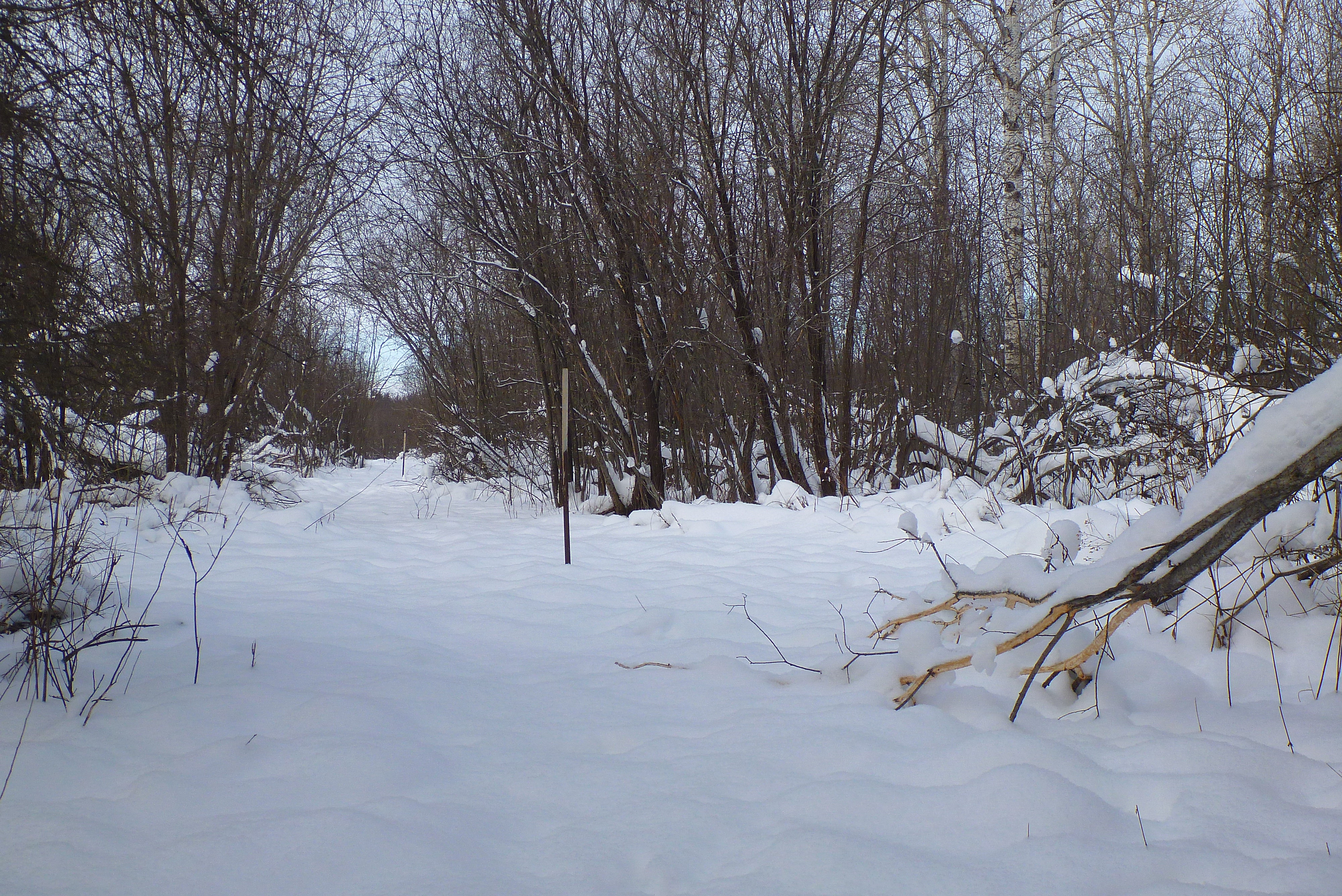
Snow Surveys have been conducted at the Corbeil Conservation Area (La Vase River subwatershed) since winter 1987-1988.
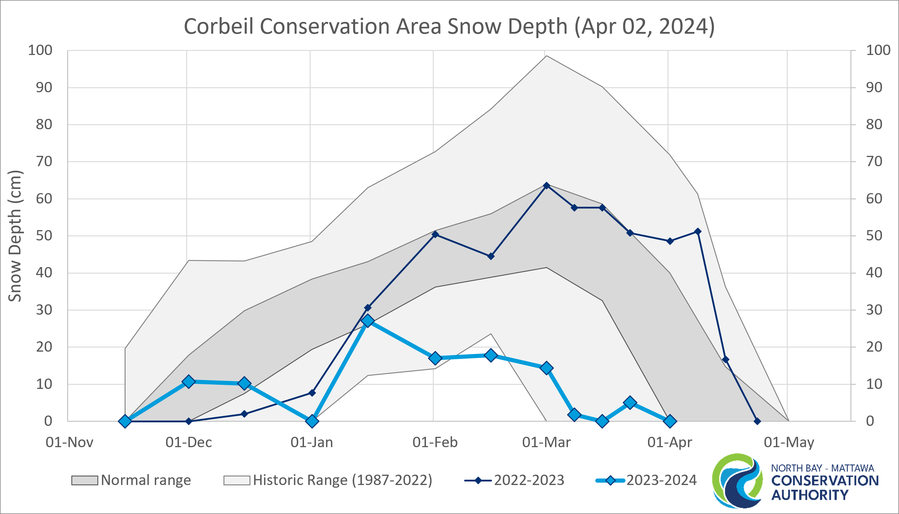
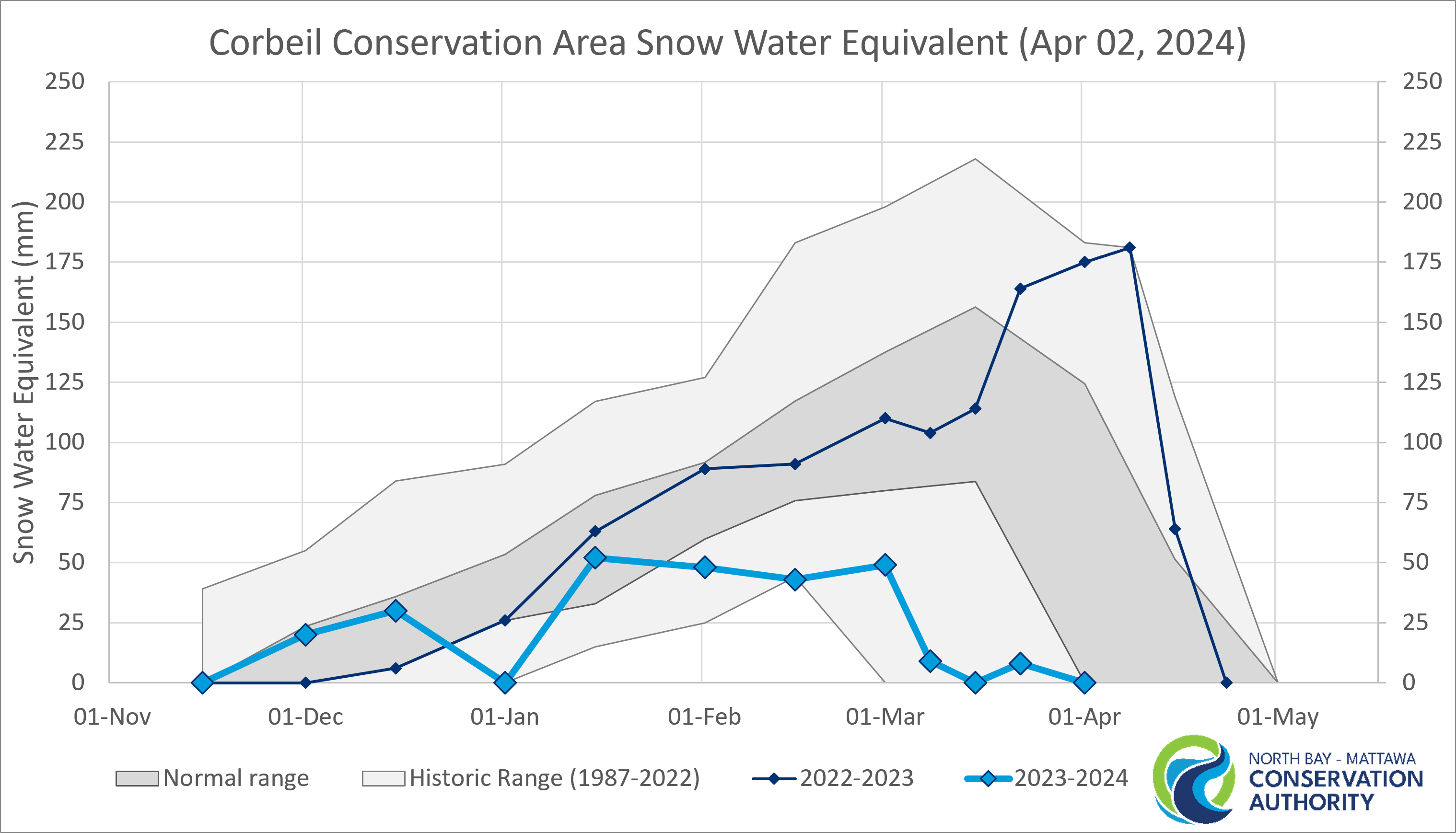
| 2023-2024 Survey date |
Measured depth (cm) | Depth status | Measure SWE (mm) | SWE status |
|
15-Nov |
0.0 |
Normal |
0 |
Normal |
|
01-Dec |
10.7 |
Normal |
20 |
Normal |
|
15-Dec |
10.2 |
Normal |
30 |
Normal |
|
02-Jan |
0.0 |
Well Below Normal |
0 |
Well Below Normal |
|
15-Jan |
27.1 | Normal | 52 | Normal |
|
01-Feb |
17.0 | Well Below Normal | 48 | Below Normal |
|
15-Feb |
17.8 | Below Historic Minimum | 43 | Below Historic Minimum |
|
01-Mar |
14.4 | Well Below Normal | 49.0 | Well Below Normal |
|
08-Mar |
1.8 | 9.0 | ||
|
15-Mar |
0 | Well Below Normal | 0 | Well Below Normal |
|
22-Mar |
5.0 | 8.0 | ||
|
02-Apr |
0 | Normal | 0 | Normal |
In more recent years, NBMCA has conducted additional surveys on the 8th and 23rd of March and April to prepare for spring freshet. More data is needed to report normal conditions for these supplemental survey dates.
Status Breakdown |
Percentile |
|
Below Historic Minimum |
< Minimum |
|
Well Below Normal |
< 10 % |
|
Below Normal |
10 % to < 25 % |
|
Normal |
25 % to < 75 % |
|
Above Normal |
75 % to < 90 % |
|
Well Above Normal |
90 % to 100 % |
|
Above Historic Maximum |
> Maximum |
Key Terms
Spring freshet – the annual high water event resulting from rapid melting of snow and spring rains. Locally, this is usually between April and May.
Normal range – historic measurements have been within this range 50 % of the time, with 25% of historic observations recorded as higher and lower than these values. It is used to describe expected conditions, limiting the influence of individual extreme high or low values.
Snow water equivalent (SWE) - the amount of water stored in the snowpack and reported as the depth of water that would cover the ground if it were in a liquid state.
Well Above Normal – this measurement compares to the highest 10% of historic measurements.
Well Below Normal – this measurement compares to the lowest 10% of historic measurements.