Flooding is the leading cause of public emergency in Ontario.
Flood management is a shared responsibility in Ontario. Conservation Authorities, including NBMCA, are on the front lines of the Provincial Flood Forecasting and Warning program.
Flooding can happen at any time. It occurs in known floodplains when there has been steady, intense rainfall or snowmelt over a short period of time. Heavy rains, snowmelt, spring break up and ice jams, wind-related storm surges, or the failure of dams can all cause flooding.
NBMCA and our 10 member municipalities prepare for, track and manage local flooding. Advance warning enables municipalities to put emergency plans into operation, evacuate communities if necessary, and secure property in areas that are more likely to flood.
Monitoring weather and flood conditions is a shared responsibility of Conservation Authorities, the Ontario Ministry of Natural Resources and Forestry, and Environment and Climate Change Canada. When flooding is possible or about to occur, NBMCA issues flood messages to municipal emergency management officials, the media and the public through our website and social media. Municipalities then take action to warn local residents.
Conservation Authorities’ responsibilities around flood management are to:
- Undertake floodplain mapping, modelling, and monitoring streamflow, rainfall and snowpacks
- Regulate development in flood-prone areas in cooperation with municipalities and the Province
- Provide planning support & advice to municipalities to minimize flood impacts and issue warnings
- Acquire important floodplain lands and flood vulnerable structure.
NBMCA brings added protection and benefits through watershed planning, watershed stewardship/natural heritage system management, stormwater management, low impact development, monitoring, and other programs.
Flood Watch Status & Terminology
The Ontario Ministry of Natural Resources & Forestry (MNRF) and Ontario's Conservation Authorities issue flood messaging using specific criteria and terminology. This provides consistency across the province and incorporates the familiar wording used by weather agencies such as Environment Canada and The Weather Network.
At any time of the year, when there is flooding, NBMCA can issue three levels of messages for the watershed within its jurisdiction:
- Water Conditions Statement (Water Safety or Flooding Outlook)
- Flood Watch
- Flood Warning
For more information on Flood Watch Status & Terminology, visit here.
Resources
The North Bay-Mattawa Conservation Authority delivers its flood forecasting program and updates for municipalities, agencies, our partners, and the public as part of our natural hazard management initiatives. These updates are based on the analysis of data and information collected in concert with the following:
- Environment Canada (Weather)
- Ministry of Natural Resources and Forestry
- North Bay-Mattawa Conservation Authority
- Ottawa River Regulating Committee
- Ottawa River Regulation Planning Board
- Sturgeon-Nipissing-French-Wanapitei Water Management Group
- Surface Water Monitoring Centre
- Water Survey of Canada
- Weather Network
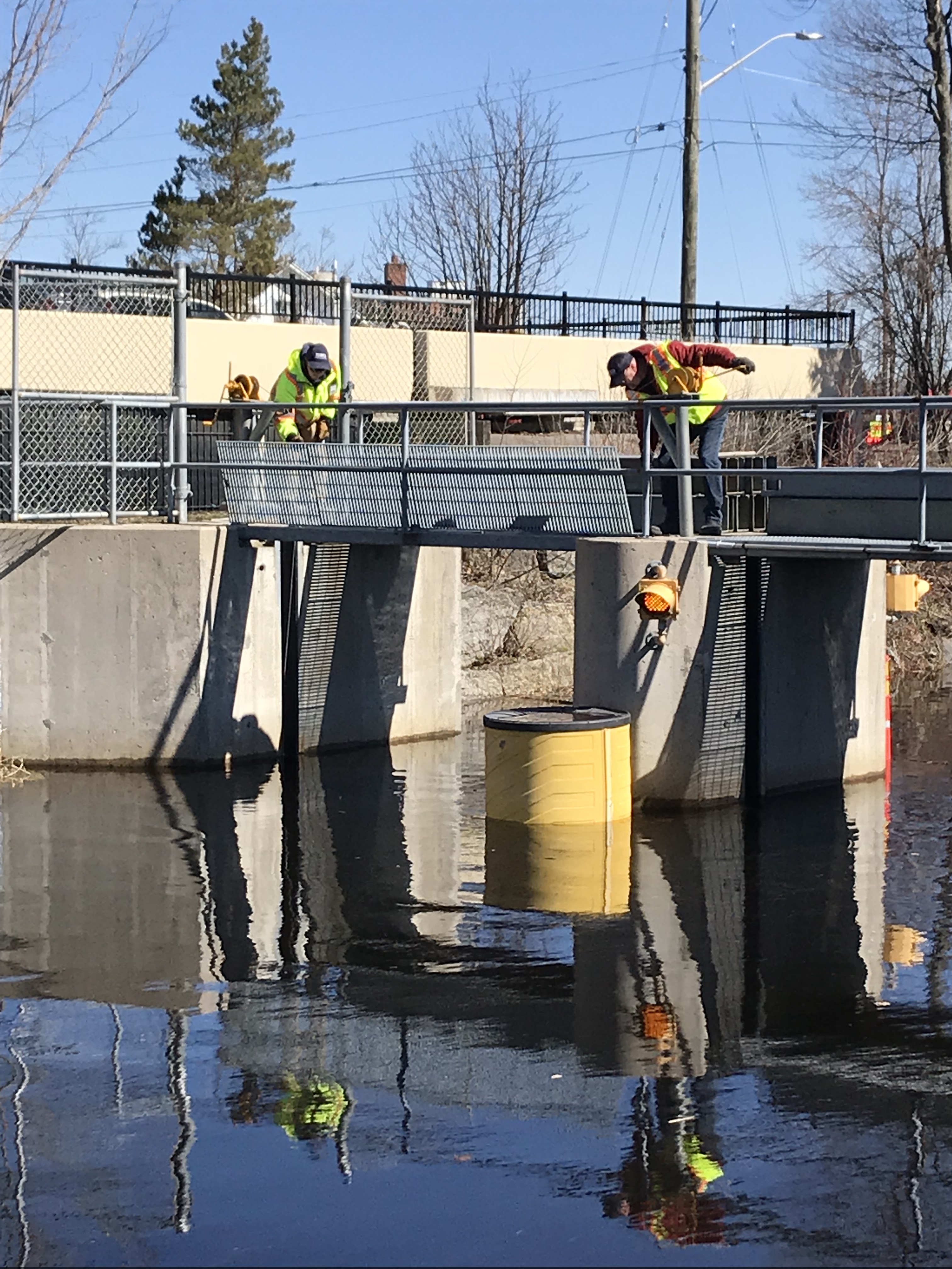
Parks Creek Backflood Control Dam - Installation of "Logs" to protect properties along Parks Creek from water rising in Lake Nipissing. April 28, 2019
Ontario Flood Strategy
In response to the Spring 2019 Flooding, the Minister of Natural Resources and Forestry appointed Doug McNeil as a Special Advisor on Flooding to review the province's current flood management framework. He was tasked with making recommendations to the government on opportunities to improve the existing flood policy framework. Drawing on the advice of Mr. McNeil, Ontario has released its Provincial Flood Strategy.
To view the Special Advisor's Full Report visit: Flood Advisor's Report
To view the Province of Ontario's Flood Strategy visit: Provincial Flood Strategy
More Information
- Flood Bulletins
- Flood Safety - Emergency Preparedness
- Flood Safety - Sewage Systems
- Flood Safety - Sandbags
- Flood Forecasting Terminology
- Parks Creek Backflood Control Structure